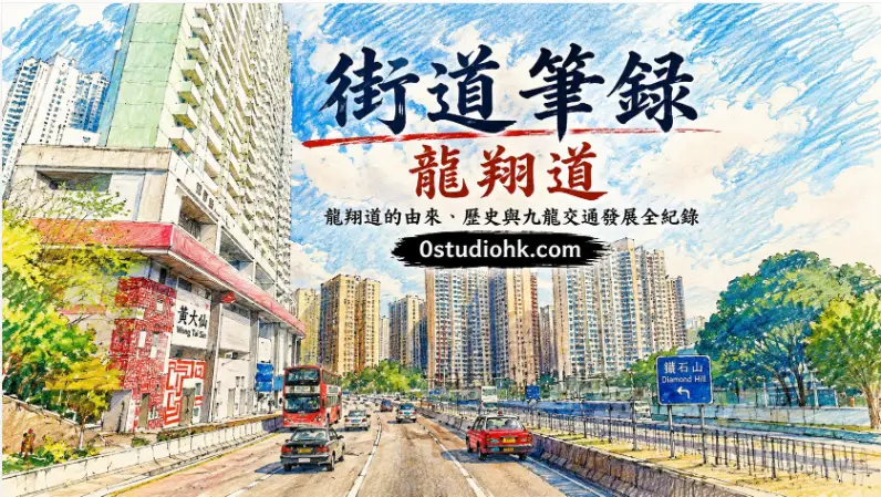
街道筆錄 | 龍翔道|龍翔道的由來、歷史與九龍交通發展全紀錄|Lung Cheung Road: History, Origin and the Evolution of Kowloon’s Major Highway
每當車輛穿越獅子山腳下,沿著龍翔道疾馳而過,許多人都視它為九龍最熟悉的道路之一。然而,這條道路不只是交通命脈,它的名字蘊含吉祥寓意,也見證九龍由山坡聚落走向現代城市的發展歷程,是香港城市建設的重要縮影。
Few roads in Hong Kong are as instantly recognizable as Lung Cheung Road. Running beneath Lion Rock and linking major districts across Kowloon, it has become an everyday route for thousands of commuters. Beyond its practical role, the road reflects decades of urban planning, infrastructure expansion, and the transformation of Kowloon from scattered hillside communities into one of the city’s busiest metropolitan regions.
中文
龍翔道位於九龍中部,是香港最重要的東西向主幹道路之一,西起呈祥道及葵涌方向,東接清水灣道及新清水灣道一帶,沿著獅子山南麓橫越深水埗、黃大仙及鑽石山等地區,多年來一直肩負連接九龍西與九龍東的重要角色。「龍翔」二字充滿中國傳統文化色彩,「龍」象徵祥瑞與力量,「翔」代表飛翔、高升,因此整個名稱寓意「飛龍翱翔」,帶有吉祥發展、城市騰飛的意思,亦配合附近以中國吉祥文化命名的道路及公共屋邨,展現當年政府命名道路時希望塑造現代城市形象的理念。龍翔道的興建始於二十世紀五、六十年代,當時香港人口急速增加,大量居民由港島及舊市區遷入九龍,新建公共屋邨如黃大仙、樂富、橫頭磡及慈雲山相繼落成,原有山區道路已無法應付不斷增長的交通需求,因此政府規劃興建一條大型快速道路,把九龍西與東九龍連接起來,同時分流彌敦道及界限街等主要幹道的交通壓力。隨著道路逐步通車,龍翔道迅速成為九龍交通網絡的重要骨幹,亦配合獅子山隧道、呈祥道及觀塘方向道路,形成完整的東西交通走廊。七十年代以後,香港經濟高速發展,龍翔道每日承載大量巴士、小巴、私家車及貨車,不少跨區巴士路線均以此作主要行車路線,令黃大仙、新蒲崗及鑽石山等地區與深水埗、荃灣及新界之間的交通更加便利。九十年代至二十一世紀,隨著地鐵網絡逐步完善,以及大型住宅發展、商業中心及公共設施增加,龍翔道附近人口持續上升,道路亦經歷多次改善工程,包括加設隔音屏障、改善天橋、優化巴士站及交通燈系統,以提升行車效率及減少對居民的影響。從城市發展角度而言,龍翔道不僅改變了交通模式,也重塑了九龍中部的城市面貌。昔日山坡及零散聚落逐漸發展成大型公共屋邨、私人住宅、商場及學校,沿線更可見黃大仙祠、獅子山、公共屋邨群及現代建築互相交織,呈現香港獨特的城市景觀。每天上下班繁忙時段,龍翔道車流絡繹不絕,成為不少香港人共同的生活記憶;而站在附近天橋遠望,車輛川流不息與獅子山背景互相映襯,也形成極具代表性的香港城市畫面。今日的龍翔道仍然是九龍交通命脈之一,不但連接多條主要公路及鐵路網絡,更支撐著住宅、商業及旅遊活動的日常運作。對不少市民而言,它是一條每天經過卻容易忽略的道路;但回望其發展歷程,龍翔道正是香港城市規劃、人口增長與交通建設同步發展的重要見證,也是九龍由工業年代走向現代都會的重要象徵。
English Version
Lung Cheung Road is one of the most significant east–west highways in Kowloon, serving as a vital transportation corridor that links western and eastern districts of the peninsula. Stretching beneath the southern slopes of Lion Rock, the route connects major residential and commercial areas while supporting thousands of daily journeys made by buses, private vehicles, taxis, and freight traffic. Although many people know the road simply as part of their daily commute, its story reflects Hong Kong’s remarkable urban transformation over the past several decades. The name “Lung Cheung” carries a distinctly Chinese character. “Lung” refers to the dragon, a traditional symbol of power, prosperity, and good fortune, while “Cheung” conveys the idea of soaring or flying gracefully. Together, the name represents a dragon rising through the sky, expressing optimism and progress. This naming approach was consistent with many roads and housing estates developed during Hong Kong’s rapid post-war expansion, where symbolic Chinese names were chosen to project confidence in the city’s future. Construction of Lung Cheung Road began during the period when Hong Kong experienced dramatic population growth in the 1950s and 1960s. Large public housing estates emerged across Wong Tai Sin, Lok Fu, Tsz Wan Shan, and surrounding neighborhoods as families relocated from crowded urban districts. Existing hillside roads could no longer cope with increasing traffic demands, prompting the government to develop a modern highway capable of connecting communities across Kowloon more efficiently. As different sections opened to traffic, the road quickly became a central component of Hong Kong’s transport network. Its strategic position allowed it to connect with other important highways and tunnels, creating a continuous corridor that significantly reduced travel times across Kowloon. During Hong Kong’s manufacturing boom in the 1970s and 1980s, Lung Cheung Road became an essential route for workers, goods, and public transport. Numerous bus services relied on the highway to connect residential districts with industrial areas, while private motorists benefited from faster cross-city travel. Continued urban expansion throughout the following decades brought further improvements. Noise barriers, pedestrian facilities, upgraded junctions, and traffic management systems were introduced to accommodate growing traffic volumes while minimizing the impact on nearby neighborhoods. Beyond transportation, the road played a major role in shaping Kowloon’s urban landscape. Hillsides once occupied by scattered settlements gradually evolved into high-rise housing estates, schools, shopping centers, and public facilities. Along the route, travelers can experience a distinctive mixture of natural scenery and dense urban development, with Lion Rock providing an iconic backdrop to one of Hong Kong’s busiest traffic corridors. This contrast between mountains and modern infrastructure has become one of the city’s defining visual identities. Today, Lung Cheung Road remains indispensable to Hong Kong’s transportation system. It connects communities, supports economic activity, and facilitates the movement of millions of residents and visitors every year. While most people simply drive through it without a second thought, the road represents far more than asphalt and concrete. It tells the story of Hong Kong’s post-war growth, its ambitious urban planning, and the determination to build infrastructure capable of supporting one of the world’s most densely populated cities. Lung Cheung Road therefore stands not only as a highway, but also as a lasting symbol of Kowloon’s development and Hong Kong’s continuing evolution into a modern global metropolis.
(中文)
龍翔道不只是連接九龍東西的重要道路,更承載香港數十年的城市發展、交通建設與居民共同回憶,見證香港不斷向前的步伐。
(English)
More than a major roadway, Lung Cheung Road reflects the growth of modern Hong Kong. It connects people, communities, and generations while preserving the story of Kowloon’s remarkable urban transformation.