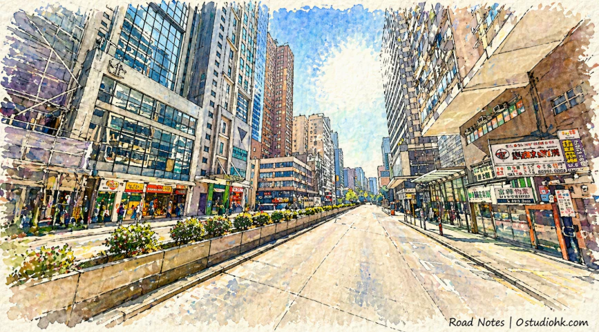
在香港九龍油尖旺區之中,彌敦道筆直延伸,貫穿繁華與人流,其名字來自殖民時代,而街道本身早已成為城市記憶的縮影。
Running through the heart of Yau Tsim Mong, Nathan Road stretches as a defining axis of Kowloon, carrying both colonial traces and the layered memories of the city’s daily life.
中文
彌敦道(Nathan Road)位於香港九龍,是一條貫穿油麻地、佐敦及尖沙咀的重要主幹道,其名稱來自19世紀香港總督彌敦爵士,他於1904年至1907年間在任,對香港基建及城市發展有一定貢獻,因此以其名字命名街道,體現殖民時期以官員命名城市空間的傳統。彌敦道的歷史可追溯至19世紀末,當時九龍半島逐步發展,英國政府開始規劃主要道路網絡,以連接不同區域及促進貿易與交通,彌敦道作為其中一條重要道路逐漸形成,並隨着城市擴展不斷延伸。早期的彌敦道與今天的繁忙景象截然不同,周邊多為低矮建築及較為鬆散的街區,但隨著20世紀的發展,特別是戰後人口急增及經濟起飛,九龍迅速城市化,彌敦道逐漸成為商業活動與交通流動的核心地帶。1960至1980年代,彌敦道兩旁出現大量商舖、酒店及娛樂場所,霓虹燈招牌林立,使其成為香港最具代表性的街道之一,亦被稱為「金光大道」,象徵着城市的繁榮與活力。進入21世紀後,雖然部分傳統霓虹招牌逐漸消失,城市景觀有所改變,但彌敦道依然保持其作為主要商業與交通走廊的地位,連接港鐵站、巴士路線及各類設施,持續承載大量人流。從城市變化角度來看,彌敦道反映了香港由殖民地港口城市發展為國際都市的過程,其街道形態與功能隨時間不斷演變,但始終保持核心地位。街道特色方面,彌敦道具有高度都市化特徵,道路寬闊且筆直,兩旁密集分布商舖、餐廳、酒店及住宅,招牌、燈光與人流交織,形成一種極具節奏感的城市空間,白天與夜晚呈現不同面貌,白天偏向商業運作,夜晚則帶有更強烈的視覺與娛樂氛圍。這種多層次的街道體驗,使彌敦道成為香港最具代表性的城市景觀之一。今日的彌敦道,不僅是一條交通主幹道,更是一條承載歷史、經濟與文化的城市長廊,它記錄着不同年代的生活方式與城市變遷,從霓虹年代到現代都市,其節奏從未停止,而人們在這條路上來來往往,也在無形之中參與着城市故事的延續。
English Version
Nathan Road is one of the most iconic thoroughfares in Kowloon, stretching through the districts of Yau Ma Tei, Jordan, and Tsim Sha Tsui, and serving as a central axis for both movement and urban life. Named after Sir Matthew Nathan, a Governor of Hong Kong in the early 20th century, the road reflects a period when colonial administrators were commemorated through urban naming practices. Its origins date back to the late 19th century, when the British administration began systematically developing Kowloon following its expansion, establishing major routes to support connectivity and economic growth. In its early years, Nathan Road was far less intense than it is today, surrounded by relatively low-rise structures and a less dense urban fabric. However, the transformation of Hong Kong in the mid-20th century, particularly after World War II, brought rapid population growth and industrial expansion, reshaping the entire area. Nathan Road evolved into a vibrant commercial spine, lined with shops, hotels, cinemas, and restaurants. During the latter half of the 20th century, it became synonymous with the visual identity of Hong Kong, especially due to the proliferation of neon signs that illuminated the street and created a distinctive nighttime atmosphere. This period solidified its reputation as a symbol of the city’s energy and prosperity. In more recent decades, while some traditional elements such as neon signage have declined, Nathan Road continues to function as a major transport and commercial corridor, integrating seamlessly with public transit systems and maintaining a high level of pedestrian activity. From an urban perspective, the road illustrates the broader evolution of Hong Kong from a colonial trading port into a global metropolis. Its physical and social landscape has continuously adapted to changing economic and cultural conditions while retaining its central role. Architecturally and spatially, Nathan Road is characterized by its straight alignment, wide carriageways, and dense vertical development. The constant interplay of movement, commerce, and visual stimuli creates a dynamic environment that shifts between day and night. Today, Nathan Road is more than just a road—it is a living narrative of the city, where layers of history, commerce, and everyday life converge. It remains a place where the past lingers within the present, and where the ongoing rhythm of urban life continues to unfold.