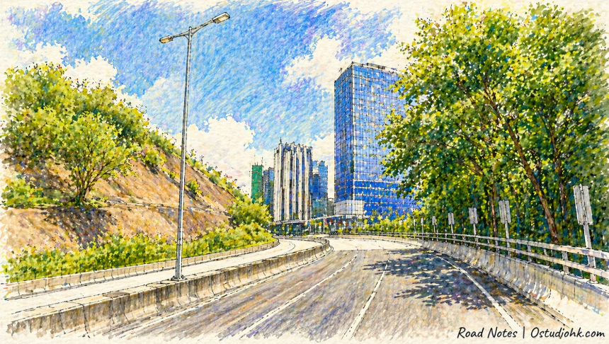
在香港九龍西的交通網絡之中,呈祥道像一條持續流動的動脈,連接不同區域,也默默見證城市擴展與基建發展的節奏。
Cutting through West Kowloon, Ching Cheung Road functions as a vital urban artery, linking districts while reflecting the evolving infrastructure and pace of the city.
中文
呈祥道(Ching Cheung Road)位於香港九龍西,是一條重要的快速幹道,其名稱屬於較具象徵意義的中文命名,「呈祥」帶有吉祥與順利之意,反映出城市道路命名中常見的正面寓意,而英文名稱則為音譯形式。與許多以人物或殖民歷史命名的街道不同,呈祥道的命名更偏向功能與象徵結合,體現香港在發展過程中逐漸形成的本地化命名特色。呈祥道的出現與香港交通基建發展密切相關,尤其在20世紀後期,隨著人口增長與汽車數量上升,九龍地區需要更完善的道路網絡以支撐跨區流動,呈祥道正是在這樣的背景下興建,成為連接深水埗、長沙灣及其他主要幹道的重要通道之一。歷史上,九龍西一帶曾以工業與住宅混合為主,街道多為較早期規劃,而呈祥道的建設代表了香港由傳統街區結構轉向現代道路系統的轉變,透過更寬闊與高效的道路設計,提升整體交通能力。進入21世紀後,隨著香港持續發展為國際城市,基建進一步優化,呈祥道亦不斷配合周邊發展進行調整,例如與快速公路系統及其他主幹道的連接,使其在城市交通中扮演更關鍵角色。從城市變化角度來看,呈祥道體現了香港由以人行與電車為主的城市,轉變為以汽車與高速交通為主導的現代都市,其存在不僅是功能性的,更反映出城市節奏的加快與空間使用方式的改變。街道特色方面,呈祥道具有典型現代幹道特徵,道路寬闊,車流量大,兩旁多為綠化帶、山坡或大型建築,缺乏傳統街道中的店舖與人行活動,使其更像一條「通過式空間」,人們多數只是經過,而非停留。這種特性使呈祥道在城市中呈現出一種與生活區域截然不同的氛圍,強調效率與流動,而非停頓與交流。今日的呈祥道,不僅是一條交通道路,更是一種城市運作方式的象徵,它代表着香港如何在有限空間中透過基建提升運輸效率,同時也提醒人們,在高速發展之中,城市的某些空間逐漸從生活場景轉變為純粹的流動通道,在不斷前行的節奏之中,這條道路持續延伸,帶着城市的動力與方向。
English Version
Ching Cheung Road, located in West Kowloon, is one of Hong Kong’s key arterial roads, designed to facilitate rapid movement across densely populated urban districts. Unlike streets named after colonial figures or historical landmarks, its name carries a symbolic meaning rooted in Chinese language, with “Ching Cheung” suggesting auspiciousness and smooth progress. This reflects a shift in naming conventions as Hong Kong evolved, incorporating more locally meaningful expressions alongside earlier colonial influences. The development of Ching Cheung Road is closely tied to the expansion of Hong Kong’s transportation infrastructure in the late 20th century. As the population grew and vehicle usage increased, the need for efficient road systems became more pressing, particularly in Kowloon, where industrial zones and residential areas coexisted in close proximity. The road was constructed as part of a broader effort to modernize the city’s transport network, providing a high-capacity route that connects major districts such as Sham Shui Po and Cheung Sha Wan with other key highways. Historically, the surrounding areas were characterized by traditional street grids and industrial activity, but the introduction of large-scale road infrastructure marked a transition toward a more modern urban form. This shift not only improved mobility but also altered how space was organized and experienced within the city. In the 21st century, continued development and integration with expressway systems have reinforced Ching Cheung Road’s importance, making it a critical component of Hong Kong’s transport ecosystem. From a broader perspective, the road illustrates the city’s transformation from a pedestrian-oriented environment to one shaped by speed and efficiency. Its physical characteristics—wide lanes, heavy traffic, limited pedestrian interaction—emphasize movement over place, distinguishing it from traditional streets where social and commercial activities take place. The surrounding landscape often includes greenery, slopes, and large-scale buildings, further reinforcing its role as a transit corridor rather than a destination. Today, Ching Cheung Road stands as a symbol of Hong Kong’s infrastructural ambition and adaptability, reflecting how the city has continually redefined its spatial priorities to accommodate growth. It is a space defined not by stillness but by motion, where the constant flow of vehicles mirrors the relentless pace of urban life, quietly shaping how people move, connect, and experience the city.