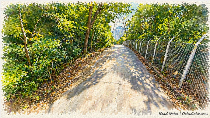
在香港東九龍的山坡邊緣,安達臣道沿着城市與自然之間延伸,名字來自殖民時代,而這條路亦見證了香港由邊緣地帶走向發展核心的轉變。
Running along the edges of East Kowloon’s hills, Anderson Road reflects a transition from peripheral terrain to an emerging urban zone, carrying echoes of its colonial naming origins.
中文
安達臣道(Anderson Road)位於香港九龍東部,連接觀塘、秀茂坪及安達臣道石礦場一帶,是一條結合山地地形與城市發展的重要道路,其名稱源自殖民時期官員或相關人物,屬於香港常見的英式命名方式之一,反映出城市早期發展與英國行政體系之間的關係。作為一條沿山而建的道路,安達臣道的形成與該區地形及土地用途密切相關,早期東九龍一帶發展較慢,部分地區以石礦開採及工業用途為主,尤其安達臣道石礦場曾是重要的建材來源地之一,為香港建設提供石料。隨著20世紀中後期香港經濟起飛,城市擴展逐漸向東推進,觀塘及秀茂坪等地發展為大型住宅區,安達臣道亦逐步由服務工業與礦業用途的道路,轉變為連接居民區的重要交通通道。進入21世紀後,隨著石礦場停產及土地重新規劃,安達臣道一帶開始出現新的發展計劃,包括大型住宅項目及基建設施,使該區由過去的邊緣地帶轉型為新興社區。從城市變化角度來看,安達臣道清晰地呈現出香港土地利用由工業轉向住宅及綜合發展的過程,亦反映出城市如何在有限空間中不斷重塑自身。街道特色方面,安達臣道具有明顯的山路特徵,道路隨地勢起伏,部分路段視野開闊,可見周邊住宅樓宇與山體景觀並存,形成一種城市與自然交錯的畫面。與傳統市區街道相比,這裡缺乏密集的商業活動,更多呈現出過渡性空間的特質,既不是完全的自然環境,也未完全都市化,帶有一種正在形成中的城市感。沿線亦可見新舊建築並存,象徵不同發展階段的重疊。今日的安達臣道,不僅是一條交通道路,更是一條記錄城市擴展軌跡的空間,它連接過去的工業用途與現在的住宅發展,也預示未來城市形態的變化,在不斷轉型之中,這條路仍然延伸,承載着香港城市邊界不斷被重新定義的過程。
English Version
Anderson Road, situated in East Kowloon, serves as a connecting corridor between districts such as Kwun Tong and Sau Mau Ping while extending toward areas that were once dominated by quarrying activity. Its name reflects the colonial-era practice of assigning English names linked to administrative figures, embedding historical governance within the city’s geography. The road’s development is closely tied to the terrain and land use patterns of the region. In earlier periods, much of East Kowloon remained less urbanized, with Anderson Road Quarry playing a significant role in supplying construction materials that supported Hong Kong’s rapid growth. As the city expanded during the latter half of the 20th century, residential developments began to replace industrial functions, transforming nearby districts into densely populated housing areas. Anderson Road evolved alongside this shift, transitioning from a route primarily serving industrial operations into a key access road for residential communities. In the 21st century, the closure of quarry operations and subsequent land redevelopment marked a new phase for the area. Large-scale housing projects and infrastructure improvements began to reshape the landscape, turning what was once considered peripheral land into an emerging urban zone. From a broader perspective, Anderson Road exemplifies Hong Kong’s capacity to continuously reconfigure its land use, adapting former industrial sites into new living environments. Spatially, the road is defined by its hillside alignment, offering varied elevations and occasional panoramic views of surrounding developments. Unlike traditional commercial streets, it lacks dense retail activity, instead presenting a transitional atmosphere where urban expansion is still in progress. The coexistence of older infrastructure and newly built structures further highlights the layered nature of development in the area. Today, Anderson Road is more than a functional route—it is a spatial narrative of transformation, linking past industrial identity with present residential growth and future urban possibilities, illustrating how Hong Kong’s boundaries are constantly reimagined through development and change.