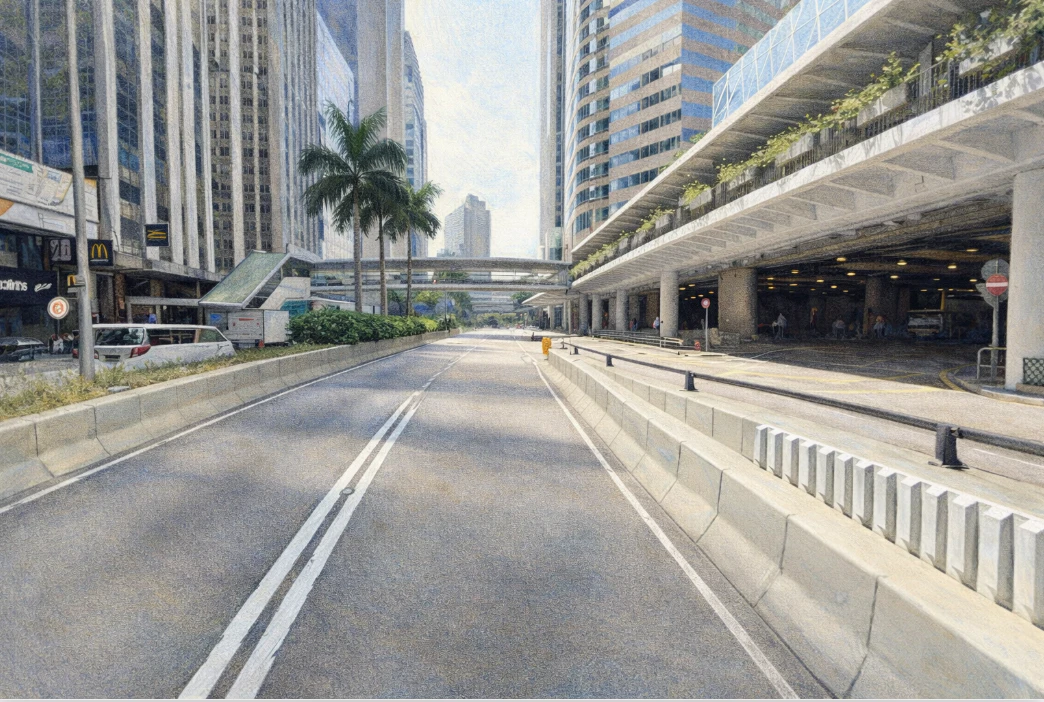
在香港中環沿著維多利亞港海旁延伸的一條重要道路,就是干諾道中。這條街由上環延伸至中環核心區,是香港島最重要的東西向幹道之一。今天的干諾道中車流繁忙,兩旁高樓林立,金融機構與大型商業大廈集中,是香港國際金融中心的重要象徵。然而若把時間倒回十九世紀中葉,這條道路的所在地其實仍然是海岸線。
干諾道中的誕生與香港城市填海工程密不可分,它見證了香港從港口城市到現代金融都市的發展歷程。香港在1841年開埠後,維多利亞城逐漸在港島北岸建立。最早的城市道路主要沿著海岸線,例如皇后大道。隨著港口貿易迅速發展,城市人口與商業活動不斷增加,政府開始進行填海工程,以擴展可用土地。十九世紀中後期,上環與中環一帶進行大規模填海,新的海旁土地逐漸形成。干諾道正是在這樣的背景下興建。道路名稱「Connaught Road」來自英國皇室人物干諾公爵(Duke of Connaught),這種以英國皇室與貴族命名街道的方式在殖民時期香港十分普遍。隨著城市發展,干諾道被分為干諾道西與干諾道中,其中干諾道中成為最繁忙的一段。十九世紀末至二十世紀初,維多利亞港逐漸成為亞洲最重要的貿易港之一。大量貨物經由香港轉口至世界各地,銀行、洋行與保險公司紛紛在中環設立辦公室。干諾道中因靠近海旁碼頭,逐漸成為商業活動的重要地區。沿街建起倉庫、商業樓宇與銀行大廈,使整條道路充滿港口城市的商業氣氛。隨著香港經濟發展,城市海岸線在二十世紀多次向北推移。新的填海工程使維多利亞港岸線逐漸遠離干諾道中,而更靠海的新道路與建築相繼出現。儘管如此,干諾道中仍然保持重要交通地位,成為中環商業區的主要道路之一。若從城市交通角度觀察,干諾道中在香港交通系統中具有關鍵角色。道路連接上環、中環與金鐘,是港島北岸的重要交通幹線。電車軌道沿著道路行駛,使這條街道成為香港電車網絡的重要部分。自1904年香港電車開始營運以來,電車一直沿著港島北岸行駛,而干諾道中正是其中的重要路段之一。從城市文化角度來看,干諾道中同樣反映香港殖民歷史與城市發展的雙重背景。街道名稱源自英國皇室,而街道兩旁的商業活動則由華人與國際企業共同推動。銀行、金融機構與跨國企業在這裡設立總部,使整條街道逐漸成為香港金融活動的重要象徵。今天走在干諾道中,可以看到玻璃幕牆的大廈與繁忙的交通。從十九世紀填海形成的海旁道路,到今日國際金融中心的核心大道,干諾道中見證了香港城市發展的一百多年歷史。當人們在這條道路上穿行時,其實也正走在香港城市與海岸線不斷改變的歷史之上。
English Version
Connaught Road Central runs along the northern edge of Hong Kong Island through Sheung Wan and Central, forming one of the most historically and economically significant east–west corridors in the city, and while today it is defined by dense traffic, towering glass-clad office buildings, and the constant movement of finance professionals, its origins lie in a very different landscape, one that was once directly connected to the waters of Victoria Harbour, before successive phases of land reclamation transformed the coastline and extended the city outward, embedding infrastructure like Connaught Road Central into newly created land that would eventually become the core of Hong Kong’s financial district; following the establishment of Hong Kong as a British colony in 1841, early urban development was concentrated along the original shoreline, with roads such as Queen’s Road tracing the edge between land and sea, but as trade expanded rapidly and Hong Kong emerged as a major port, the demand for land intensified, prompting large-scale reclamation projects throughout the nineteenth century, and it was within this context that Connaught Road was constructed, later divided into sections including Connaught Road Central, with its name referencing the Duke of Connaught and reflecting the colonial practice of inscribing imperial identity into the urban environment; as Victoria Harbour grew into one of the busiest ports in Asia, Central developed into a hub for international trade, attracting banks, trading houses, and insurance companies, and Connaught Road Central, positioned near the waterfront and adjacent to key commercial areas, became a vital artery supporting both the movement of goods and the concentration of economic activity, with warehouses, offices, and commercial buildings lining the street and contributing to a dynamic port-city landscape; over time, as Hong Kong’s economy shifted from trade-based to finance-driven, the character of the area surrounding Connaught Road Central evolved accordingly, with older structures gradually replaced by modern high-rise buildings housing global financial institutions, transforming the road into a symbol of Hong Kong’s status as an international financial center, while still retaining its original alignment as a product of earlier reclamation efforts; from a transportation perspective, the road continues to play a critical role in connecting key districts such as Sheung Wan, Central, and Admiralty, facilitating the daily flow of vehicles and linking with major transport systems including trams, buses, and nearby railway stations, and the presence of tram tracks along the corridor adds a historical layer to the modern urban environment, where the slow and steady movement of trams contrasts with the fast-paced rhythm of financial activity, creating a unique coexistence of past and present; geographically, the relationship between the road and Victoria Harbour has changed dramatically over time, as continued reclamation throughout the twentieth century pushed the shoreline further north, leaving Connaught Road Central no longer at the water’s edge but still carrying the memory of its maritime origins, a reminder of how the city has continuously reshaped its physical boundaries to accommodate growth; architecturally, the street presents a skyline of glass and steel, with corporate headquarters and commercial towers dominating the view, yet traces of earlier development can still be found in the urban fabric, offering glimpses into different phases of the city’s evolution; culturally, Connaught Road Central reflects the layered identity of Hong Kong, where its English name points to colonial heritage while its daily use is defined by a diverse population of local residents and international professionals, illustrating how global and local forces intersect within the city’s core; throughout the day, the road is characterized by intense activity, with traffic congestion, pedestrian movement, and commercial transactions occurring simultaneously, while at night the illuminated buildings and quieter streets create a different atmosphere that still conveys a sense of continuity and function; ultimately, Connaught Road Central is more than a transportation route, it is a spatial narrative that encapsulates Hong Kong’s transformation from a coastal trading post into a global financial hub, demonstrating how land reclamation, economic development, and urban planning converge to shape the identity of a city, and for those who traverse it, the experience is not merely one of movement but of engaging with a landscape that carries over a century of history, adaptation, and ambition.