伊利沙伯醫院路位於九龍油麻地,是連接醫療設施與城市街區的重要道路。圍繞伊利沙伯醫院發展而成,這條道路見證香港公共醫療體系與城市規劃的演變,亦承載着病人、醫護與市民的日常流動,是一條兼具功能與人文意義的城市通道。
Queen Elizabeth Hospital Road is located in Yau Ma Tei, Kowloon, serving as a key connector between medical facilities and surrounding urban neighborhoods. Developed alongside Queen Elizabeth Hospital, the road reflects the evolution of Hong Kong’s public healthcare system and urban planning. It functions not only as infrastructure but also as a human-centered corridor shaped by the daily movements of patients, healthcare workers, and residents.
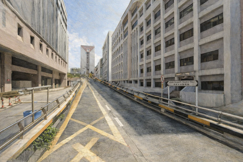
伊利沙伯醫院路位於九龍油麻地一帶,是一條與香港公共醫療體系緊密相連的道路,其存在與發展幾乎與伊利沙伯醫院本身不可分割。從地理位置來看,這條道路並不是傳統意義上的主要幹道,但它在城市網絡中的角色卻極為關鍵,因為它承載着醫療、交通與社區之間的連結。伊利沙伯醫院於二十世紀中期落成,是香港最重要的公立醫院之一,其規模與功能使周邊地區逐漸形成以醫療服務為核心的城市空間,而伊利沙伯醫院路正是在這樣的背景下出現,成為連接醫院各個入口與外部道路的重要通道。與一般商業街道不同,這條道路的節奏更貼近生命本身,它不只是人流與車流的通道,更是一條承載情緒與故事的路。每天都有救護車、的士與私家車進出,病人、家屬與醫護人員在這裡交錯而行,形成一種獨特的城市流動。這種流動並不以消費或商業為主,而是圍繞着治療、照顧與等待,呈現出另一種城市節奏。從城市規劃角度來看,伊利沙伯醫院路反映了香港在戰後快速發展公共醫療系統的過程。隨著人口增加與城市密度提升,政府需要建立大型綜合醫院以應對醫療需求,而這些醫院往往成為區域性的核心設施,帶動周邊交通與基礎建設的發展。伊利沙伯醫院路作為配套道路,不僅服務醫院本身,也連接油麻地與何文田等周邊地區,使整個區域形成一個以醫療為中心的城市節點。沿路的建築景觀亦具有明顯的功能性特徵,醫院建築群、相關設施與部分住宅樓宇交錯排列,缺乏大型商業廣告與消費空間,使整體環境顯得相對簡潔而實用。這種空間特質使人們在行走其中時,感受到一種與一般城市街道不同的氛圍,較少喧鬧,多了一份專注與緊張。從文化角度來看,伊利沙伯醫院路同樣承載着香港殖民歷史的痕跡。道路名稱來自英國女王伊利沙伯,反映殖民時期對皇室的命名傳統,但隨著時間推移,這個名稱已經融入本地語境之中,成為日常生活的一部分。與此同時,街道上的實際生活場景則完全由香港市民所構成,這種名稱與現實之間的落差,正是香港城市文化的一種典型特徵。當夜幕降臨,伊利沙伯醫院路仍然保持一定的活動量,急症服務不間斷,燈光照亮道路與建築,使整個區域呈現出一種持續運作的狀態。這條道路沒有明顯的開始與結束,它更像是一個系統中的一部分,一個圍繞醫療與生命運作的城市空間。對於許多人來說,這裡或許只是經過的一段路,但對於病人與醫護而言,它卻可能是一段重要的人生記憶。
English Version
Queen Elizabeth Hospital Road, situated in Yau Ma Tei in Kowloon, is a street whose identity is inseparable from the presence of Queen Elizabeth Hospital, one of Hong Kong’s most significant public medical institutions, and although it may not function as a major arterial road in the conventional sense, its importance within the urban network is substantial, as it operates as a critical connector between healthcare infrastructure and the surrounding city, facilitating the constant movement of patients, medical staff, emergency services, and visitors, and in doing so, it reveals a dimension of urban life that is often less visible yet deeply essential; the road emerged alongside the development of the hospital in the mid-twentieth century, during a period when Hong Kong was rapidly expanding its public healthcare system in response to population growth and increasing demand for medical services, and as large-scale hospitals were established, they became focal points within the urban landscape, shaping not only the physical layout of surrounding streets but also the social and functional dynamics of the area, with Queen Elizabeth Hospital Road serving as a key access route linking multiple entrances of the hospital complex to external roads and nearby districts such as Yau Ma Tei and Ho Man Tin; unlike commercial streets defined by retail activity and consumer behavior, the rhythm of this road is structured around care, urgency, and waiting, where ambulances arrive and depart, taxis queue briefly before moving on, and individuals walk with purpose, often carrying emotional weight tied to health, recovery, or uncertainty, creating a unique urban atmosphere that is quieter in sound yet more intense in human significance; from an urban planning perspective, the road exemplifies how infrastructure is adapted to support specialized functions within the city, reflecting a post-war emphasis on public welfare and institutional development, where accessibility, efficiency, and connectivity were prioritized to ensure that essential services could operate effectively within a dense metropolitan environment; architecturally, the surroundings of Queen Elizabeth Hospital Road are characterized by functional design, with hospital buildings, auxiliary facilities, and nearby residential structures forming a landscape that is practical rather than ornamental, lacking the visual density of commercial signage found in other parts of Kowloon, and this contributes to a sense of clarity and focus within the space; culturally, the road also embodies the layered identity of Hong Kong, where its English name, derived from Queen Elizabeth, points to its colonial origins, while its everyday use reflects the lived experiences of local residents, illustrating how historical naming conventions have been integrated into contemporary life without necessarily defining it; as day transitions into night, the activity along the road does not cease, as emergency services continue to operate and the hospital remains active around the clock, with artificial lighting maintaining visibility and reinforcing the sense that this is a space of continuous function, rather than one that follows typical commercial or residential cycles; ultimately, Queen Elizabeth Hospital Road represents a different kind of urban narrative, one that is not centered on commerce, spectacle, or tourism, but on care, resilience, and the fundamental needs of a city’s population, and in this way, it highlights how even relatively understated streets can hold profound significance within the broader structure of urban life, serving as both physical connectors and emotional landscapes where countless personal stories unfold.